Within the hydrosphere research topic of the EDA Alliance five higher-level image products were specified which are listed in the following table. In general, the interest of the users at the soil moisture product was quite high. In total, of the 101 respondents who took part in the survey, 39 were interested in “Soil Moisture” products, 8 in “Ocean Surface Currents”, 10 in “Coastal Area Change” and 9 in the “Wind Speed Velocity Map”.
| Product | Scale | Spatial Resolution | Accuracy | Temporal Resolution |
|---|---|---|---|---|
| Soil Moisture | Local | 50 m x 50 m | 5 - 10 [vol%] | 1 - 2 times per week |
| Soil Moisture Change | Local | 50 m x 50 m | 5 - 10 [vol%] | 1 - 2 times per week |
| Ocean Surface Current | Coastal regions (worldwide) | 50 m x 50 m | 5 cm/s | every 5 days |
| Coastal Area Change | Coastal regions (worldwide) | 50 m x 50 m | 10 cm | yearly |
| Wind Speed Velocity Map | Coastal regions (worldwide) | 4 km x 4 km or 20 km x 20 km | 2 cm/s for surface winds between 2 m/s and 20 m/s | <= 5 days |
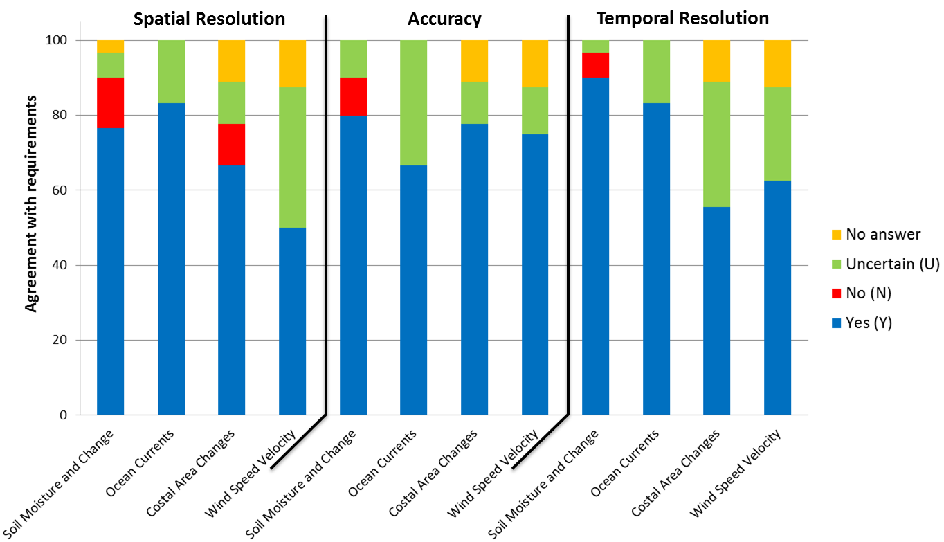
The conformance of the user requirements with the specified product parameters is shown in the following figure. It can be observed that most of the users were satisfied with the product specifications. In case of the “Soil Moisture and Change” products a small number of respondents were asking for a better spatial resolution and a higher accuracy. Concerning the spatial resolution it is the goal to generate the soil moisture products with a pixel spacing of 20 x 20 m. However, a higher accuracy can currently not be promised due to system specifications.

Conformance of the user requirements with the product specifications (Spatial Resolution, Accuracy, and Temporal Resolution) for the hydrosphere products.
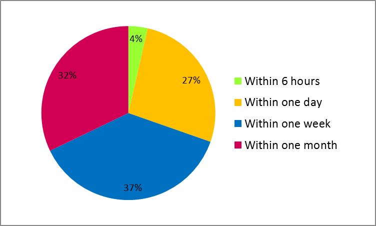
Regarding the product availability, the next figure shows the distribution of the corresponding user requests. As expected, most of the respondents require the products quite fast. Approximately 27% of the users need the products within one day after image acquisition and 37% within one week. Currently, a latency of 4 days is indicated for the specified hydrosphere products which meet at least the requirements of the majority of the users.

